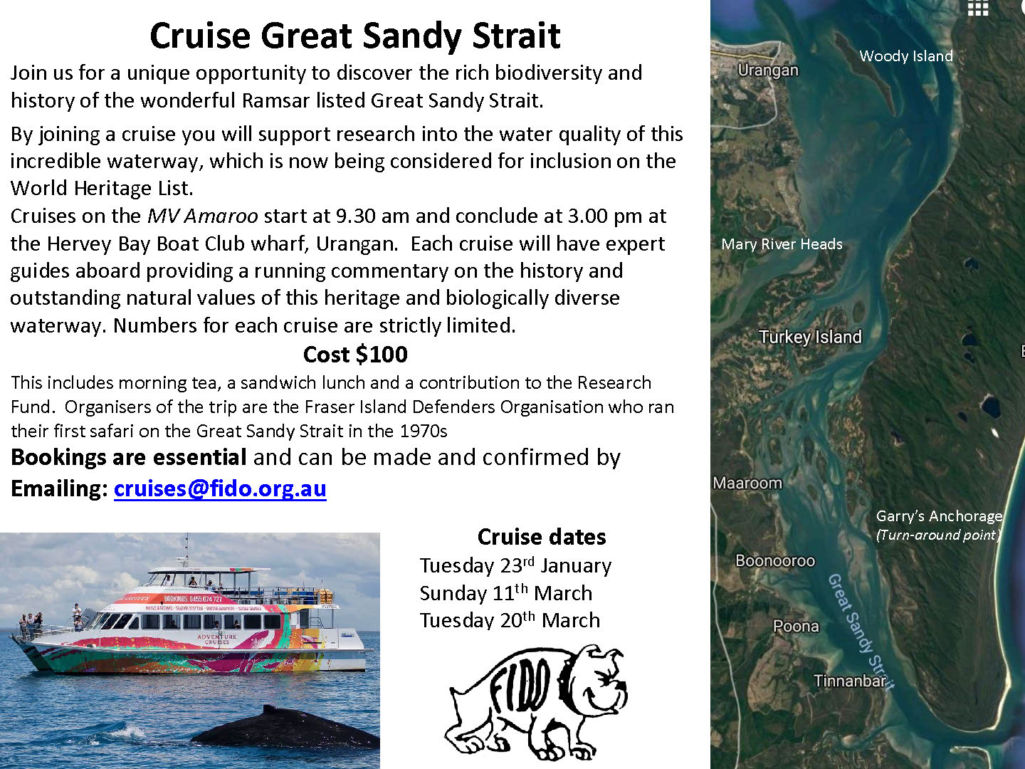
Latest News
Great Sandy Strait — A Wetland of International Significance
Great Sandy Strait (which includes Tin Can Bay) is a Wetland of International Significance. It was inscribed as Ramsar site 992 in 1999. Its 93,160 ha includes marine, estuarine and intertidal wetlands and salt pans. The intertidal wetland habitats consist of: 15,500 ha of mangrove forests, 12,300 ha of intertidal and subtidal seagrass beds, 2,800 ha of saltmarshes, unvegetated mud, sand and salt flats, and estuarine and channel waters of varying depth and width. The main freshwater wetland types are Melaleuca swamp forest and other palustrine wetlands. It is a very special place deserving the highest level of protection. The Draft Great Sandy Marine Park Zoning offered it little extra protection.
Read more from this Moonbi Backgrounder
Where Two Tides Meet
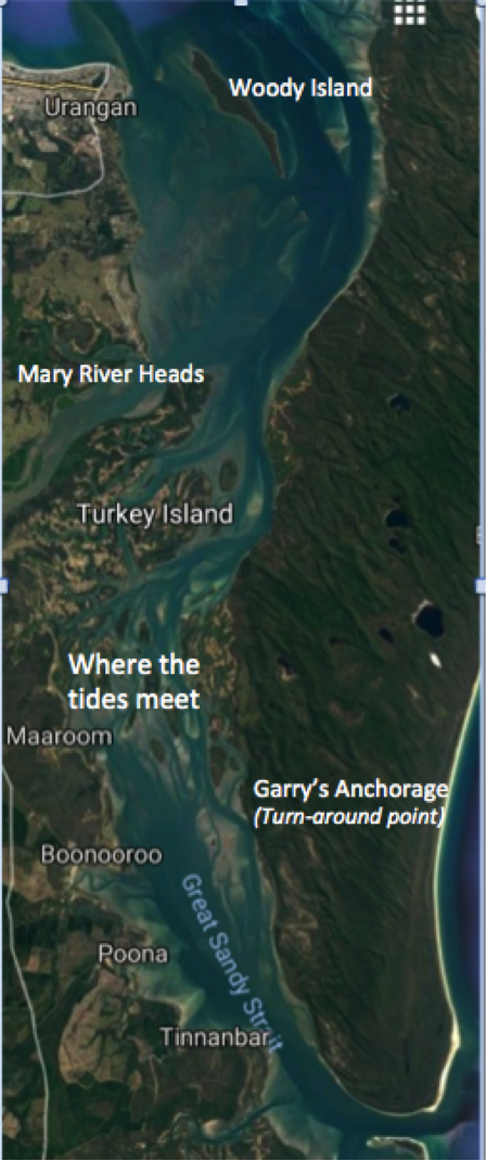 Because the Mary River follows a generally northwards direction from its source in the Conondale Ranges up to Maryborough and because Mary River Heads are close to Hervey Bay, many people wrongly assume that the river continues it northerly flow and discharges into Hervey Bay.
From ancient times the Woody Island Syncline blocked off the river’s northwards flow. When sea levels were 120 metres lower than at present, that syncline caused the river to change direction and flow south.
Until about 10,000 years ago the Mary River discharged into the ocean off the edge of the continental shelf north east of Double Island Point. Great Sandy Strait is the ancestral bed of the Mary River. It is only in recent geological times since the sea-level has risen that the Mary River can discharge into Hervey Bay but that only occurs in times of floods in the river when the flow is strong enough to push past the Woody Island group at the northern end of Great Sandy Strait that largely still blocks most of the northerly flow.
In normal times the incoming tide funneling down from the north prevents the flow of the river into Hervey Bay. It diverts the flow southwards along Great Sandy Strait. Here though, the discharge meets a tide flowing up from the south past Inskip Point. Where the tides meet a huge fallout of sediment has created the mosaic of tidal mudflats and low mangrove islands. It is similar in many respects to a river delta except that it occurs away from the river’s nominal mouth.
It is this lack of understanding of local geography that has caused the many people to get the whole story and their understanding of the Great Sandy Strait Ramsar site so appallingly wrong. Great Sandy Strait is an open-ended estuary and it is where the two tided meet that there has been the greatest accumulation of sediment. Sediment washed down the Mary River had built up to a depth of about 100 metres in Central Great Sandy Strait where the two tided meet.
Where the tides meet is the greatest accumulation of sediment and nutrients. Unsurprisingly it is the biologically richest part of Great Sandy Strait. Here the greatest aggregations of trans-equatorial shorebirds gather during summer. It is also very vulnerable to the impacts of pollutants in the discharged mine water.